
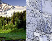
- Overview of ArcGIS Pro
- Pro User Interface: Ribbon, Panes, and Views
- Map, Layout, Catalog, and Model Panes
- Adding Data to a Map
- Data Management and Metadata
- Querying and Selecting Geographic Features
- Symbolizing Geographic Features
- Labeling Geographic Features
- Working with Feature Attributes
- Editing Geographic Features and Attributes
- Common Geoprocessing Tools
- Intermediate and Advanced Spatial Analysis Concepts
- Introduction to Extensions including the Spatial Analyst
- Creating and Sharing Cartographic Products
Planned Maintenance — August 8-9, 2026
We will be performing scheduled website maintenance this weekend. During this time, the site may be temporarily unavailable.
We appreciate your patience. If you need to register for a course or have questions, please contact us at info@nwetc.org or 425-270-3274.